
There are 7 ways to get from Austin to South Fork by plane, car, bus, shuttle, or taxi
Select an option below to see step-by-step directions and to compare ticket prices and travel times in Rome2Rio's travel planner.
Fly to Gunnison County Airport, drive
best- Fly from Austin-Bergstrom International Airport (AUS) to Gunnison County Airport (GUC)plane AUS - GUC
- Drive from Gunnison County Airport (GUC) to South Forkcar
8h 8m$123–537Bus, drive via Ciudad Juárez
- Take the bus from Austin Eastside Bus Plaza to San Antonio Bus Stationbus
- Take the bus from San Antonio Bus Station to El Paso Bus Stationbus
- Take the bus from El Paso Bus Station to Santa Febus
- Take the bus from South Capitol Station - Shelter 1 to Espanola Transit Centerbus 160 / ...
- Take the bus from Espanola Transit Center to Pine Avenue & 4th Streetbus 190
- Drive from Pine Avenue & 4th Street to South Forkcar
25h 40m$181–306Drive 874.6 mi
- Drive from Austin to South Forkcar 874.6 mi
14h 59m$160–231Fly to Durango–La Plata County Airport, bus
- Fly from Austin-Bergstrom International Airport (AUS) to Durango–La Plata County Airport (DRO)plane AUS - DRO
- Take a shuttle bus from Durango, CO - Airport to Pagosa Springs, CO
9h 31m$331–747Fly to Aspen–Pitkin County Airport, drive
- Fly from Austin-Bergstrom International Airport (AUS) to Aspen–Pitkin County Airport (ASE)plane AUS - ASE
- Drive from Aspen–Pitkin County Airport (ASE) to South Forkcar
8h 1m$126–542Fly to San Luis Valley Regional Airport, taxi
- Fly from Austin-Bergstrom International Airport (AUS) to San Luis Valley Regional Airport (ALS)plane AUS - ALS
- Take the taxi from San Luis Valley Regional Airport (ALS) to South Forktaxi
6h 41m$261–552Bus, drive
- Take the bus from Austin Doubletree University Area to Fort Worthbus
- Take the bus from Fort Worth Downtown to Pueblo Transitbus
- Take the bus from Pueblo, CO to Santa Febus
- Take the bus from South Capitol Station - Shelter 1 to Espanola Transit Centerbus 160 / ...
- Take the bus from Espanola Transit Center to Pine Avenue & 4th Streetbus 190
- Drive from Pine Avenue & 4th Street to South Forkcar
29h 26m$321–451
Austin-Bergstrom International Airport (AUS) to Gunnison County Airport (GUC) flights
Questions & Answers
The cheapest way to get from Austin to South Fork is to drive which costs $160 - $240 and takes 14h 59m.
The fastest way to get from Austin to South Fork is to fly and taxi which takes 6h 41m and costs $260 - $550.
The distance between Austin and South Fork is 918 miles. The road distance is 879.7 miles.
It takes approximately 8h 8m to get from Austin to South Fork, including transfers.
South Fork is 1h behind Austin. It is currently 5:04 PM in Austin and 4:04 PM in South Fork.
Yes, the driving distance between Austin to South Fork is 880 miles. It takes approximately 14h 59m to drive from Austin to South Fork.
There are 111+ hotels available in South Fork.
What companies run services between Austin, TX, USA and South Fork, CO, USA?
There is no direct connection from Austin to South Fork. However, you can take the line 20 bus to ABIA Lower Level, walk to Austin-Bergstrom International Airport (AUS) airport, fly to Gunnison County Airport (GUC), then drive to South Fork. Alternatively, you can take a bus from Austin Eastside Bus Plaza to South Fork via San Antonio Bus Station, El Paso Bus Station, Santa Fe, South Capitol Station - Shelter 1, Espanola Transit Center, and Pine Avenue & 4th Street in around 25h 40m.
- Website
- united.com
Flights from Austin-Bergstrom International Airport to Gunnison County Airport via Denver
- Ave. Duration
- 5h 1m
- When
- Every day
- Estimated price
- $100–550
Flights from Austin-Bergstrom International Airport to Gunnison County Airport via Houston
- Ave. Duration
- 6h 20m
- When
- Saturday
- Estimated price
- $110–550
Flights from Austin-Bergstrom International Airport to Durango–La Plata County Airport via Denver
- Ave. Duration
- 5h 15m
- When
- Every day
- Estimated price
- $110–550
Flights from Austin-Bergstrom International Airport to Aspen–Pitkin County Airport via Denver
- Ave. Duration
- 4h 40m
- When
- Every day
- Estimated price
- $100–550
Flights from Austin-Bergstrom International Airport to Aspen–Pitkin County Airport via Houston
- Ave. Duration
- 5h 16m
- When
- Every day
- Estimated price
- $110–550
- Website
- aa.com
Flights from Austin-Bergstrom International Airport to Gunnison County Airport via Dallas/Ft.Worth
- Ave. Duration
- 5h 10m
- When
- Every day
- Estimated price
- $100–500
Flights from Austin-Bergstrom International Airport to Durango–La Plata County Airport via Dallas/Ft.Worth
- Ave. Duration
- 4h 55m
- When
- Every day
- Estimated price
- $100–500
Flights from Austin-Bergstrom International Airport to Durango–La Plata County Airport via Phoenix
- Ave. Duration
- 5h 31m
- When
- Every day
- Estimated price
- $130–600
Flights from Austin-Bergstrom International Airport to Aspen–Pitkin County Airport
- Ave. Duration
- 2h 32m
- When
- Every day
- Estimated price
- $95–490
Flights from Austin-Bergstrom International Airport to Aspen–Pitkin County Airport via Dallas/Ft.Worth
- Ave. Duration
- 5h 26m
- When
- Every day
- Estimated price
- $100–500
- Website
- keylimeair.com
Flights from Austin-Bergstrom International Airport to San Luis Valley Regional Airport via Denver
- Ave. Duration
- 4h 24m
- When
- Every day
- Estimated price
- $75–370
Flights from Austin-Bergstrom International Airport to San Luis Valley Regional Airport via Dallas, Denver
- Ave. Duration
- 6h 15m
- When
- Sunday and Wednesday
- Estimated price
- $80–380
Flights from Austin-Bergstrom International Airport to San Luis Valley Regional Airport via Midland/Odessa, Denver
- Ave. Duration
- 7h 5m
- When
- Monday, Thursday, and Friday
- Estimated price
- $80–390
Flights from Austin-Bergstrom International Airport to San Luis Valley Regional Airport via Will Rogers World, Denver
- Ave. Duration
- 8h 5m
- When
- Sunday
- Estimated price
- $80–390
- Website
- jsx.com
Flights from Austin-Bergstrom International Airport to Gunnison County Airport via Dallas
- Ave. Duration
- 4h 25m
- When
- Monday, Thursday, and Friday
- Estimated price
- $100–500
Rome2Rio's guide to Greyhound USA
Contact DetailsContact Details
- Phone
- +1 214-849-8100
- [email protected]
- Website
- Greyhound
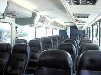
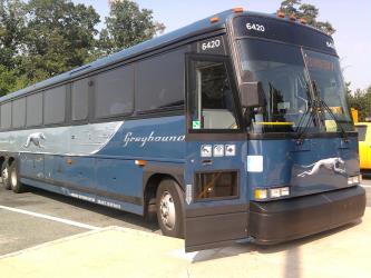
Bus from Austin Eastside Bus Plaza to San Antonio Bus Station
- Ave. Duration
- 1h 35m
- Frequency
- Every 2 hours
- Estimated price
- $11–23
- Website
- Greyhound
Bus from San Antonio Bus Station to El Paso Bus Station
- Ave. Duration
- 10h 25m
- Frequency
- Twice daily
- Estimated price
- $80–160
- Website
- Greyhound
- Phone
- +1 (855) 626-8585
- Website
- Flixbus USA
Bus from Austin Eastside Bus Plaza to San Antonio Bus Station
- Ave. Duration
- 1h 30m
- Frequency
- Every 4 hours
- Estimated price
- $12–21
- Schedules at
- Flixbus USA
Bus from Fort Worth Downtown to Pueblo Transit
- Ave. Duration
- 13h 50m
- Frequency
- Twice daily
- Estimated price
- $110–200
- Schedules at
- Flixbus USA

- Phone
- +1 800-923-1799
- [email protected]
- Website
- Omnibus Express
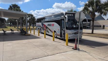
Bus from El Paso Bus Station to Santa Fe
- Ave. Duration
- 5h 4m
- Frequency
- Once daily
- Estimated price
- $70–95
- Schedules at
- Omnibus Express
Bus from Pueblo, CO to Santa Fe
- Ave. Duration
- 4h
- Frequency
- Once daily
- Estimated price
- $65–85
- Schedules at
- Omnibus Express
- Phone
- 1.866.206.0754
- Website
- NCRTD
Bus from South Capitol Station - Shelter 1 to Espanola Transit Center
- Ave. Duration
- 42 min
- Frequency
- Every 4 hours
- Website
- NCRTD
- Passenger
- $0
Bus from Espanola Transit Center to Pine Avenue & 4th Street
- Ave. Duration
- 1h 57m
- Frequency
- Twice daily
- Website
- NCRTD
- Passenger
- $0
Bus from South Capitol Station - Shelter 1 to Espanola Transit Center
- Ave. Duration
- 42 min
- Frequency
- Every 4 hours
- Website
- NCRTD
- Passenger
- $0
Bus from Espanola Transit Center to Pine Avenue & 4th Street
- Ave. Duration
- 1h 57m
- Frequency
- Twice daily
- Website
- NCRTD
- Passenger
- $0
- Phone
- 1-970-731-4081
- [email protected]
- Website
- Wilderness Journeys
Shuttle from Durango, CO - Airport to Pagosa Springs, CO
- Ave. Duration
- 1h
- Frequency
- On demand
- Estimated price
- $135
- Website
- Wilderness Journeys
- Book at
- Wilderness Journeys
- Phone
- +1 844-866-5263
- [email protected]
- Website
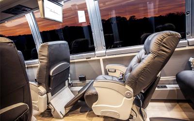
- Vonlane
Bus from Austin Doubletree University Area to Fort Worth
- Ave. Duration
- 3h
- Frequency
- Twice daily
- Estimated price
- $127–137
- Website
- Vonlane
- Adult
- $127
- adult
- $137



Want to know more about travelling around United States
Rome2Rio's Travel Guide series provide vital information for the global traveller. Filled with useful and timely travel information, the guides answer all the hard questions - such as 'How do I buy a ticket?', 'Should I book online before I travel? ', 'How much should I expect to pay?', 'Do the trains and buses have Wifi?' - to help you get the most out of your next trip.
Related travel guides
Travelling to the US: What do I need to know?
Read the travel guide
Need to know: Greyhound
Read the travel guide