
There are 4 ways to get from Brandeis University to Cape Cod Canal by train, subway, bus, or car
Select an option below to see step-by-step directions and to compare ticket prices and travel times in Rome2Rio's travel planner.
Train, subway, bus
best- Take the train from Brandeis/Roberts to Portertrain
- Take the subway from Porter to South Stationsubway
- Take the bus from Boston South Buses to Park & Ride, Exit 1A/B - Jct. US 6bus
2h 35m$40–57Drive 66.2 mi
cheapest- Drive from Brandeis University to Cape Cod Canalcar 66.2 mi
1h 20m$13–18Line 505 bus, bus
- Take the bus from Maple St @ Crescent St to Lincoln St @ Essex Stbus 505
- Take the bus from Boston South Buses to Park & Ride, Exit 1A/B - Jct. US 6bus Hyannis - South Shore to Logan Airport / ...
2h 46m$38–51Line 505 bus, bus via Boston
- Take the bus from Maple St @ Crescent St to Lincoln St @ Essex Stbus 505
- Take the bus from Boston to Sagamore Circlebus Bz 0950 / ...
3h 19m$26–41
Comparing Your Travel Options
The cheapest way to get from Brandeis University to Cape Cod Canal is to drive which costs $12 - $18 and takes 1h 20m.
The fastest way to get from Brandeis University to Cape Cod Canal is to drive which takes 1h 20m and costs $12 - $18.
No, there is no direct bus from Brandeis University to Cape Cod Canal. However, there are services departing from Maple St @ Crescent St and arriving at Park & Ride, Exit 1A/B - Jct. US 6 via Boston South Buses. The journey, including transfers, takes approximately 2h 46m.
The distance between Brandeis University and Cape Cod Canal is 71 miles. The road distance is 66.6 miles.
The best way to get from Brandeis University to Cape Cod Canal without a car is to train and subway and bus which takes 2h 35m and costs $40 - $60.
It takes approximately 2h 35m to get from Brandeis University to Cape Cod Canal, including transfers.
Brandeis University to Cape Cod Canal bus services, operated by MBTA, depart from Maple St @ Crescent St station.
Brandeis University to Cape Cod Canal bus services, operated by MBTA, arrive at Lincoln St @ Essex St station.
Yes, the driving distance between Brandeis University to Cape Cod Canal is 67 miles. It takes approximately 1h 20m to drive from Brandeis University to Cape Cod Canal.
There are 389+ hotels available in Cape Cod Canal.
What companies run services between Brandeis University, MA, USA and Cape Cod Canal, MA, USA?
You can take a vehicle from Brandeis University to Cape Cod Canal via Maple St @ Crescent St, Lincoln St @ Essex St, Boston South Buses, and Park & Ride, Exit 1A/B - Jct. US 6 in around 2h 46m.
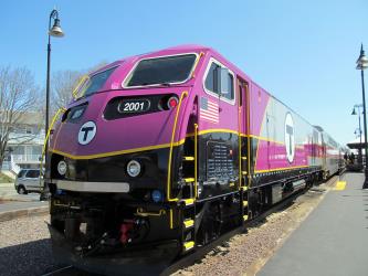
Train from Brandeis/Roberts to Porter
- Ave. Duration
- 17 min
- Frequency
- Hourly
- Estimated price
- $1–7
- Website
- Massachusetts Bay Transportation Authority
- Website
- MBTA: World Cup 2026
- Adult
- $1–7
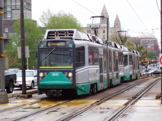
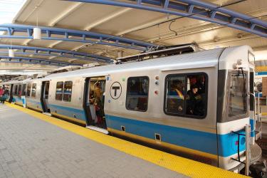
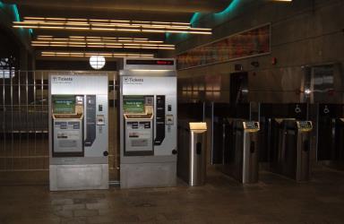
Subway from Porter to South Station
- Ave. Duration
- 16 min
- Frequency
- Every 10 minutes
- Estimated price
- $3
- Website
- MBTA - Massachusetts Bay Transportation Authority
- Schedules at
- Subway Schedules
- Adult
- $3

- Phone
- +1 (508) 746-0378
- [email protected]
- Website
- Plymouth & Brockton
Bus from Boston South Buses to Park & Ride, Exit 1A/B - Jct. US 6
- Ave. Duration
- 1h 10m
- Frequency
- Hourly
- Estimated price
- $22–29
- Website
- Plymouth & Brockton
- One Way - Adult
- $22–29
Bus from Boston South Buses to Park & Ride, Exit 1A/B - Jct. US 6
- Ave. Duration
- 1h 10m
- Frequency
- Hourly
- Estimated price
- $22–29
- Website
- Plymouth & Brockton
- One Way - Adult
- $22–29

Bus from Maple St @ Crescent St to Lincoln St @ Essex St
- Ave. Duration
- 37 min
- Frequency
- Every 2 hours
- Estimated price
- $1–5
- Website
- Massachusetts Bay Transportation Authority
- Website
- MBTA: World Cup 2026
Bus from Maple St @ Crescent St to Lincoln St @ Essex St
- Ave. Duration
- 37 min
- Frequency
- Every 2 hours
- Estimated price
- $1–5
- Website
- Massachusetts Bay Transportation Authority
- Website
- MBTA: World Cup 2026
- Phone
- 1-800-343-9999
- Website
- Peter Pan
Bus from Boston to Sagamore Circle
- Ave. Duration
- 1h 10m
- Frequency
- Every 3 hours
- Estimated price
- $10–19
- Website
- Peter Pan
Want to know more about travelling around the world?
Rome2Rio's Travel Guide series provide vital information for the global traveller. Read our range of informative guides on popular transport routes and companies - including Travelling to the US: What do I need to know?, 4 stunningly beautiful Philippines islands you need to visit, and Travelling to and around Russia for the 2018 FIFA World Cup - to help you get the most out of your next trip.