
There are 4 ways to get from Central Intelligence Agency to Washington by bus, subway, taxi, or car
Select an option below to see step-by-step directions and to compare ticket prices and travel times in Rome2Rio's travel planner.
Line 29 bus, subway
best- Take the bus from Macarthur Blvd & Goldsboro Rd to Friendship Heights Station & Bay Ebus 29
- Take the subway from Friendship Heights, Red Line Center Platform to Farragut North, Red Line Center Platformsubway R
57 min$4–7Drive 8.5 mi
cheapest- Drive from Central Intelligence Agency to Washingtoncar 8.5 mi
14 min$2–3Line 29 bus, bus
- Take the bus from Macarthur Blvd & Goldsboro Rd to Friendship Heights Station & Bay Ebus 29
- Take the bus from Friendship Heights+Bay C to H St NW+Madison Pl NWbus D80
1h 27m$5–7Taxi
- Take the taxi from Central Intelligence Agency to Washingtontaxi 8.5 mi
14 min$27–33
Comparing Your Travel Options
The cheapest way to get from Central Intelligence Agency to Washington is to drive which costs $1 - $3 and takes 14 min.
The fastest way to get from Central Intelligence Agency to Washington is to taxi which takes 14 min and costs $27 - $33.
No, there is no direct bus from Central Intelligence Agency to Washington. However, there are services departing from Macarthur Blvd & Goldsboro Rd and arriving at H St NW+Madison Pl NW via Friendship Heights+Bay C. The journey, including transfers, takes approximately 1h 27m.
The distance between Central Intelligence Agency and Washington is 11 miles. The road distance is 8.5 miles.
The best way to get from Central Intelligence Agency to Washington without a car is to line 29 bus and subway which takes 57 min and costs $4 - $8.
It takes approximately 57 min to get from Central Intelligence Agency to Washington, including transfers.
Central Intelligence Agency to Washington bus services, operated by Montgomery County MD Ride On, depart from Macarthur Blvd & Goldsboro Rd station.
Central Intelligence Agency to Washington bus services, operated by Montgomery County MD Ride On, arrive at Friendship Heights Station & Bay E.
Yes, the driving distance between Central Intelligence Agency to Washington is 9 miles. It takes approximately 14 min to drive from Central Intelligence Agency to Washington.
There are 1330+ hotels available in Washington.
What companies run services between Central Intelligence Agency, VA, USA and Washington, DC, USA?
You can take a vehicle from Central Intelligence Agency to H St NW+Madison Pl NW via Macarthur Blvd & Goldsboro Rd, Friendship Heights Station & Bay E, and Friendship Heights+Bay C in around 1h 27m.
Subway from Friendship Heights, Red Line Center Platform to Farragut North, Red Line Center Platform
- Ave. Duration
- 11 min
- Frequency
- Every 10 minutes
- Estimated price
- $2–3
- Website
- Washington Metropolitan Area Transit Authority
- standard fare after 9:30 p.m
- $2–3
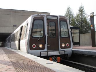
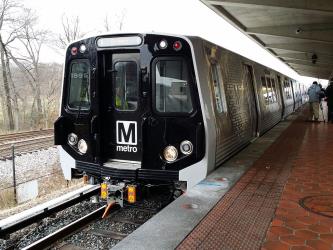
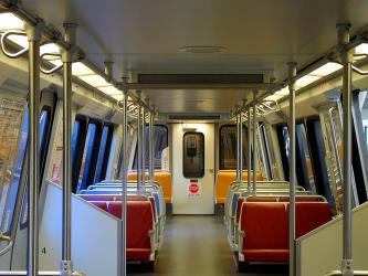
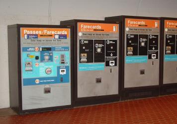

- Website
- montgomerycountymd.gov
Bus from Macarthur Blvd & Goldsboro Rd to Friendship Heights Station & Bay E
- Ave. Duration
- 15 min
- Frequency
- Hourly
- Estimated price
- $2–5
- Schedules at
- montgomerycountymd.gov
Bus from Macarthur Blvd & Goldsboro Rd to Friendship Heights Station & Bay E
- Ave. Duration
- 15 min
- Frequency
- Hourly
- Estimated price
- $2–5
- Schedules at
- montgomerycountymd.gov
Bus from Friendship Heights+Bay C to H St NW+Madison Pl NW
- Ave. Duration
- 39 min
- Frequency
- Every 10 minutes
- Estimated price
- $3
- Website
- Washington Metropolitan Area Transit Authority
- Standard fare
- $3
- Ave. Duration
- 14 min
- Estimated price
- $27–33
Grand Cab
- Phone
- +1 202-269-6690
- Website
- grandcab.com
Washington DC Taxi Service
- Phone
- +1 202-657-0008
- Website
- dctaxiservice.com
Yellow Cab DC
- Phone
- +1 (202) 544-1212
- Website
- dcyellowcab.com
Want to know more about travelling around the world?
Rome2Rio's Travel Guide series provide vital information for the global traveller. Read our range of informative guides on popular transport routes and companies - including Heading to Europe? Read this before you buy a Eurail Pass, How to get from Florence to Rome, and Travelling to and around Russia for the 2018 FIFA World Cup - to help you get the most out of your next trip.