
There are 6 ways to get from Great Falls to National Harbor by taxi, subway, bus, or car
Select an option below to see step-by-step directions and to compare ticket prices and travel times in Rome2Rio's travel planner.
Taxi, subway, bus via King St-Old Town, Yellow/Blue Line Center Platform
best- Take the taxi from Great Falls to Wiehle-Reston East, Silver Line Center Platformtaxi
- Take the subway from Wiehle-Reston East, Silver Line Center Platform to Rosslyn, Blue/Orange/Silver Line Track 1 Platformsubway S
- Take the bus from King St-Old Town+Bay J to St George Bl+Waterfront Stbus P90
2h$50–58Drive 27.4 mi
cheapest- Drive from Great Falls to National Harborcar 27.4 mi
36 min$5–8Subway, bus
- Take the subway from Spring Hill, Silver Line Center Platform to L'Enfant Plaza, Blue/Orange/Silver Line Center Platformsubway S
- Take the bus from D St SW+6 St SW to St George Bl+Waterfront Stbus C11
2h 14m$15–20Taxi
- Take the taxi from Great Falls to National Harbortaxi 27.4 mi
36 min$80–100Taxi, subway, bus
- Take the taxi from Great Falls to Wiehle-Reston East, Silver Line Center Platformtaxi
- Take the subway from Wiehle-Reston East, Silver Line Center Platform to L'Enfant Plaza, Blue/Orange/Silver Line Center Platformsubway S
- Take the bus from D St SW+6 St SW to St George Bl+Waterfront Stbus C11
2h 21m$49–57Bus
- Take the bus from Tysons+Bay G to King Street-Old Town+Bay Cbus F20
2h 25m$27–32
Questions & Answers
The cheapest way to get from Great Falls to National Harbor is to drive which costs $5 - $8 and takes 36 min.
The fastest way to get from Great Falls to National Harbor is to drive which takes 36 min and costs $5 - $8.
No, there is no direct bus from Great Falls to National Harbor. However, there are services departing from Tysons+Bay G and arriving at St George Bl+Waterfront St via King St-Old Town+Bay J. The journey, including transfers, takes approximately 2h 25m.
The distance between Great Falls and National Harbor is 51 miles. The road distance is 27.6 miles.
The best way to get from Great Falls to National Harbor without a car is to taxi and subway and bus via King St-Old Town, Yellow/Blue Line Center Platform which takes 2h and costs $45 - $60.
It takes approximately 2h to get from Great Falls to National Harbor, including transfers.
Great Falls to National Harbor bus services, operated by Washington Metropolitan Area Transit Authority, depart from Tysons+Bay G station.
Great Falls to National Harbor bus services, operated by Washington Metropolitan Area Transit Authority, arrive at King Street-Old Town+Bay C station.
Yes, the driving distance between Great Falls to National Harbor is 28 miles. It takes approximately 36 min to drive from Great Falls to National Harbor.
There are 1325+ hotels available in National Harbor.
What companies run services between Great Falls, VA, USA and National Harbor, MD, USA?
Washington Metropolitan Area Transit Authority operates a bus from Tysons+Bay G to King Street-Old Town+Bay C every 15 minutes. Tickets cost $3 and the journey takes 1h 32m.
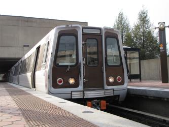
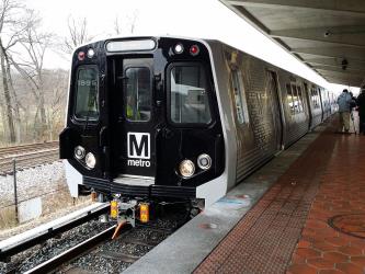
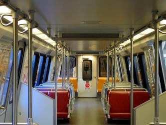
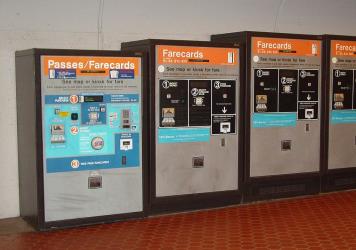
Subway from Wiehle-Reston East, Silver Line Center Platform to Rosslyn, Blue/Orange/Silver Line Track 1 Platform
- Ave. Duration
- 29 min
- Frequency
- Every 15 minutes
- Estimated price
- $2–3
- Website
- Washington Metropolitan Area Transit Authority
- standard fare after 9:30 p.m
- $2–3
Subway from Spring Hill, Silver Line Center Platform to L'Enfant Plaza, Blue/Orange/Silver Line Center Platform
- Ave. Duration
- 35 min
- Frequency
- Every 15 minutes
- Estimated price
- $2–3
- Website
- Washington Metropolitan Area Transit Authority
- standard fare after 9:30 p.m
- $2–3
Subway from Wiehle-Reston East, Silver Line Center Platform to L'Enfant Plaza, Blue/Orange/Silver Line Center Platform
- Ave. Duration
- 41 min
- Frequency
- Every 15 minutes
- Estimated price
- $2–3
- Website
- Washington Metropolitan Area Transit Authority
- standard fare after 9:30 p.m
- $2–3

Bus from King St-Old Town+Bay J to St George Bl+Waterfront St
- Ave. Duration
- 20 min
- Frequency
- Every 30 minutes
- Estimated price
- $3
- Website
- Washington Metropolitan Area Transit Authority
- Standard fare
- $3
Bus from D St SW+6 St SW to St George Bl+Waterfront St
- Ave. Duration
- 1h 2m
- Frequency
- Every 20 minutes
- Estimated price
- $3
- Website
- Washington Metropolitan Area Transit Authority
- Standard fare
- $3
Bus from D St SW+6 St SW to St George Bl+Waterfront St
- Ave. Duration
- 1h 2m
- Frequency
- Every 20 minutes
- Estimated price
- $3
- Website
- Washington Metropolitan Area Transit Authority
- Standard fare
- $3
Bus from Tysons+Bay G to King Street-Old Town+Bay C
- Ave. Duration
- 1h 32m
- Frequency
- Every 15 minutes
- Estimated price
- $3
- Website
- Washington Metropolitan Area Transit Authority
- Standard fare
- $3
- Ave. Duration
- 29 min
- Estimated price
- $40–100
Want to know more about travelling around the world?
Rome2Rio's Travel Guide series provide vital information for the global traveller. Read our range of informative guides on popular transport routes and companies - including 4 stunningly beautiful Philippines islands you need to visit, How to get from JFK to New York City, and Train travel in Spain: A guide to Renfe - to help you get the most out of your next trip.