
There are 5 ways to get from Mandaluyong City to Fort Santiago by ferry, bus, taxi, car, or foot
Select an option below to see step-by-step directions and to compare ticket prices and travel times in Rome2Rio's travel planner.
River Ferry
best- Take the ferry from Pup to Escoltaferry Downstream
29 minBus
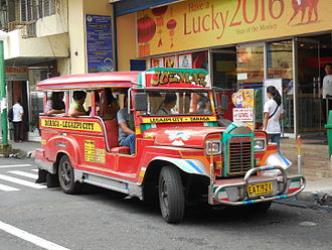
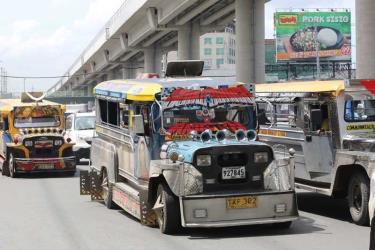
cheapest- Take the bus from Shaw Blvd / Acacia Ln Intersection, Mandaluyong City to Sto. Cristo / Claro M. Recto Ave Intersection, Manilabus Antipolo-Divisoria via Shaw Blvd
1h 10m₱22–35Taxi
- Take the taxi from Mandaluyong City to Fort Santiagotaxi 12.1 km
16 min₱220–280Drive 12.1 km
- Drive from Mandaluyong City to Fort Santiagocar 12.1 km
16 min₱97–140Walk
- Take the walk from Mandaluyong City to Fort Santiagowalk 12.1 km
2h 25m
Questions & Answers
The cheapest way to get from Mandaluyong City to Fort Santiago is to River Ferry which costs and takes 29 min.
The fastest way to get from Mandaluyong City to Fort Santiago is to taxi which takes 16 min and costs ₱220 - ₱280.
Yes, there is a direct bus departing from Shaw Blvd / Acacia Ln Intersection, Mandaluyong City and arriving at Sto. Cristo / Claro M. Recto Ave Intersection, Manila. Services depart every 15 minutes, and operate every day. The journey takes approximately 46 min.
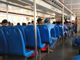
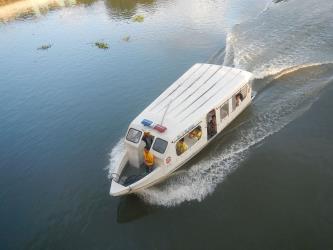
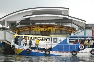
Yes, there is a direct ferry departing from Pup and arriving at Escolta. Services depart hourly, and operate Monday to Saturday. The journey takes approximately 15 min.
The distance between Mandaluyong City and Fort Santiago is 6 km. The road distance is 12.1 km.
The best way to get from Mandaluyong City to Fort Santiago without a car is to River Ferry which takes 29 min and costs .
The River Ferry from Pup to Escolta takes 15 min including transfers and departs hourly.
Mandaluyong City to Fort Santiago bus services, operated by Jeepney - LTFRB, depart from Shaw Blvd / Acacia Ln Intersection, Mandaluyong City station.
Mandaluyong City to Fort Santiago bus services, operated by Jeepney - LTFRB, arrive at Sto. Cristo / Claro M. Recto Ave Intersection, Manila station.
Yes, the driving distance between Mandaluyong City to Fort Santiago is 12 km. It takes approximately 16 min to drive from Mandaluyong City to Fort Santiago.
What companies run services between Mandaluyong City, Philippines and Fort Santiago, Philippines?
Pasig River Ferry Service operates a ferry from Pup to Escolta hourly, and the journey takes 15 min. Alternatively, Jeepney - LTFRB operates a bus from Shaw Blvd / Acacia Ln Intersection, Mandaluyong City to Sto. Cristo / Claro M. Recto Ave Intersection, Manila every 15 minutes. Tickets cost ₱22–35 and the journey takes 46 min.
- Phone
- 8926-6346
- [email protected]
- Website
- LTFRB
Bus from Shaw Blvd / Acacia Ln Intersection, Mandaluyong City to Sto. Cristo / Claro M. Recto Ave Intersection, Manila
- Ave. Duration
- 46 min
- Frequency
- Every 15 minutes
- Estimated price
- ₱22–35
- Website
- LTFRB
- Phone
- 02 882-4151 to 77
- [email protected]
- Website
- mmda.gov.ph
Ferry from Pup to Escolta
- Ave. Duration
- 15 min
- Frequency
- Hourly
- Schedules at
- mmda.gov.ph
- Ave. Duration
- 16 min
- Estimated price
- ₱220–280
Basic Taxi
- Phone
- +63 2 352 7777
- Website
- facebook.com
Dollar Taxi
Grab Taxi
- Website
- grab.com
Green GSM
- Phone
- +63 2 7777 8080
- Website
- greengsm.ph
MGE Taxi
R&E Taxi
- Phone
- +63 2 3529089
- Website
- web.facebook.com
Want to know more about travelling around Philippines
Rome2Rio's Travel Guide series provide vital information for the global traveller. Filled with useful and timely travel information, the guides answer all the hard questions - such as 'How do I buy a ticket?', 'Should I book online before I travel? ', 'How much should I expect to pay?', 'Do the trains and buses have Wifi?' - to help you get the most out of your next trip.
Related travel guides
4 stunningly beautiful Philippines islands you need to visit
Read the travel guide
More Questions & Answers
There are 11520+ hotels available in Fort Santiago.