
There are 4 ways to get from Pacific Heights to Palo Alto by bus, train, car, or taxi
Select an option below to see step-by-step directions and to compare ticket prices and travel times in Rome2Rio's travel planner.
Line 45 bus, Caltrain
best- Take the bus from Union St & Fillmore St to Townsend St & Lusk Stbus 45
- Take the train from San Francisco Caltrain Southbound to California Avenue Caltrain Southboundtrain Local Weekday / ...
1h 46m$9–12Line 28 bus, bus
cheapest- Take the bus from Lombard St & Fillmore St to Daly City BART Parking Lot Ebus 28
- Take the bus from Daly City BART-Bay 1 to Palo Alto Transit Ctr-Bay 1bus Ecr
3h 7m$4–6Drive 34.1 mi
- Drive from Pacific Heights to Palo Altocar 34.1 mi
41 min$7–9Taxi
- Take the taxi from Pacific Heights to Palo Altotaxi 34.1 mi
41 min$120–150
Pacific Heights to Palo Alto by bus and train
Questions & Answers
The cheapest way to get from Pacific Heights to Palo Alto is to line 28 bus and bus which costs $4 - $6 and takes 3h 7m.
The fastest way to get from Pacific Heights to Palo Alto is to drive which takes 41 min and costs $6 - $9.
No, there is no direct bus from Pacific Heights to Palo Alto. However, there are services departing from Lombard St & Fillmore St and arriving at Palo Alto Transit Ctr-Bay 1 via Daly City BART-Bay 1. The journey, including transfers, takes approximately 3h 7m.
The distance between Pacific Heights and Palo Alto is 37 miles. The road distance is 34.3 miles.
The best way to get from Pacific Heights to Palo Alto without a car is to line 45 bus and Caltrain which takes 1h 46m and costs $9 - $12.
It takes approximately 1h 46m to get from Pacific Heights to Palo Alto, including transfers.
Pacific Heights to Palo Alto bus services, operated by San Francisco Municipal Transportation Agency, depart from Lombard St & Fillmore St station.
Pacific Heights to Palo Alto bus services, operated by San Francisco Municipal Transportation Agency, arrive at Daly City BART Parking Lot E station.
Yes, the driving distance between Pacific Heights to Palo Alto is 34 miles. It takes approximately 41 min to drive from Pacific Heights to Palo Alto.
There are 457+ hotels available in Palo Alto.
What companies run services between Pacific Heights, CA, USA and Palo Alto, CA, USA?
You can take a bus from Lombard St & Fillmore St to Palo Alto Transit Ctr-Bay 1 via Daly City BART-Bay 1 in around 3h 7m.
- Phone
- +1 800-660-4287
- Website
- Cal Train
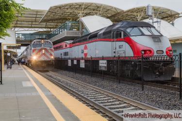
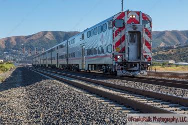
Train from San Francisco Caltrain Southbound to California Avenue Caltrain Southbound
- Ave. Duration
- 52 min
- Frequency
- Every 30 minutes
- Estimated price
- $7–10
- Website
- Cal Train
- Schedules at
- Cal Train
- One-way Adult
- $7–10

Bus from Union St & Fillmore St to Townsend St & Lusk St
- Ave. Duration
- 37 min
- Frequency
- Every 20 minutes
- Estimated price
- $2–3
- Website
- San Francisco Municipal Transportation Agency
- Schedules at
- San Francisco Municipal Transportation Agency Routes
Bus from Lombard St & Fillmore St to Daly City BART Parking Lot E
- Ave. Duration
- 45 min
- Frequency
- Every 15 minutes
- Estimated price
- $2–3
- Website
- San Francisco Municipal Transportation Agency
- Schedules at
- San Francisco Municipal Transportation Agency Routes
- Website
- SamTrans Homepage
Bus from Daly City BART-Bay 1 to Palo Alto Transit Ctr-Bay 1
- Ave. Duration
- 2h 15m
- Frequency
- Every 15 minutes
- Estimated price
- $2–4
- Website
- SamTrans Homepage
- Website
- SamTrans Schedules
- Ave. Duration
- 41 min
- Estimated price
- $120–150
Coastside TAxi
- Phone
- +1 650-333-3505
- Website
- coastsidetaxi.com
SF Green Cab
- Phone
- +1 415-626-4733
- Website
- greencabsf.com
Yellow Cab
- Phone
- +1 415.333.3333
- Website
- yellowcabsf.com
Want to know more about travelling around the world?
Rome2Rio's Travel Guide series provide vital information for the global traveller. Read our range of informative guides on popular transport routes and companies - including The beginner’s guide to the 2018 World Nomad Games, 5 delightfully under-the-radar French towns you need to visit, and Flying into Beijing? - to help you get the most out of your next trip.