
There are 2 ways to get from Pictured Rocks National Lakeshore to Sault Ste. Marie by car or bus
Select an option below to see step-by-step directions and to compare ticket prices and travel times in Rome2Rio's travel planner.
Questions & Answers
The cheapest way to get from Pictured Rocks National Lakeshore to Sault Ste. Marie is to drive which costs $35 - $55 and takes 2h 12m.
The fastest way to get from Pictured Rocks National Lakeshore to Sault Ste. Marie is to drive which takes 2h 12m and costs $35 - $55.
The distance between Pictured Rocks National Lakeshore and Sault Ste. Marie is 182 km. The road distance is 182.2 km.
It takes approximately 2h 12m to drive 182.2 km from Grand Sable Visitor's Center to Sault Ste. Marie.
Yes, the driving distance between Pictured Rocks National Lakeshore to Sault Ste. Marie is 182 km. It takes approximately 2h 12m to drive from Pictured Rocks National Lakeshore to Sault Ste. Marie.
There are 45+ hotels available in Sault Ste. Marie.
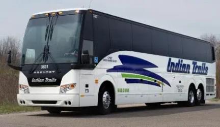
What companies run services between Pictured Rocks National Lakeshore, MI, USA and Sault Ste. Marie, ON, Canada?
You can drive from Grand Sable Visitor's Center to Sault Ste. Marie in around 2h 12m.
- Phone
- +1 989-725-5105
- Website
- indiantrails.com
Bus from Newberry, MI to Sault Ste. Marie, MI
- Ave. Duration
- 1h 5m
- Frequency
- Twice daily
- Estimated price
- $16–40
- Website
- https://indiantrails.com
Want to know more about travelling around the world?
Rome2Rio's Travel Guide series provide vital information for the global traveller. Read our range of informative guides on popular transport routes and companies - including How to get from JFK to New York City, Want to know more about Flixbus?, and Travelling by boat in Italy - to help you get the most out of your next trip.