
There are 5 ways to get from Union Station to National Geospatial-Intelligence Agency by bus (Greyhound), taxi, car, subway, or bus
Select an option below to see step-by-step directions and to compare ticket prices and travel times in Rome2Rio's travel planner.
Bus, line 371 bus
best- Take the bus from Washington Union Station to Springfield Bus Stopbus Greyhound US0600 / ...
- Take the bus from Franconia-Springfield Metro Bay G to 7620 Backlick Rdbus 371
1h 19m$3–7Taxi
- Take the taxi from Union Station to National Geospatial-Intelligence Agencytaxi 16.4 mi
20 min$45–60Drive 16.4 mi
- Drive from Union Station to National Geospatial-Intelligence Agencycar 16.4 mi
20 min$3–5Subway, line 371 bus
- Take the subway from Union Station, Red Line Center Platform to Farragut North, Red Line Center Platformsubway R
- Take the subway from Farragut West, Blue/Orange/Silver Line Track 2 Platform to Franconia-Springfield, Blue Line Center Platformsubway B
- Take the bus from Franconia-Springfield Metro Bay G to 7620 Backlick Rdbus 371
1h 42m$5–8Subway, line 341 bus
- Take the subway from Union Station, Red Line Center Platform to Metro Center, Red Line Track 2 Platformsubway R
- Take the subway from Metro Center, Blue/Orange/Silver Line Center Platform to Franconia-Springfield, Blue Line Center Platformsubway B
- Take the bus from Franconia-Springfield Metro to Fort Belvoir North Areabus 340 / ...
2h 31m$4–6
Questions & Answers
The cheapest way to get from Union Station to National Geospatial-Intelligence Agency is to drive which costs $3 - $5 and takes 20 min.
The fastest way to get from Union Station to National Geospatial-Intelligence Agency is to taxi which takes 20 min and costs $45 - $60.
No, there is no direct bus from Union Station station to National Geospatial-Intelligence Agency. However, there are services departing from Washington Union Station and arriving at 7620 Backlick Rd via Franconia-Springfield Metro Bay G. The journey, including transfers, takes approximately 1h 19m.
The distance between Union Station and National Geospatial-Intelligence Agency is 20 miles. The road distance is 16.5 miles.
The best way to get from Union Station to National Geospatial-Intelligence Agency without a car is to bus and line 371 bus which takes 1h 19m and costs $3 - $8.
It takes approximately 1h 19m to get from Union Station to National Geospatial-Intelligence Agency, including transfers.
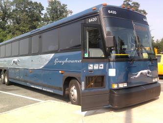
Union Station to National Geospatial-Intelligence Agency bus services, operated by Greyhound USA, depart from Washington Union Station.
Union Station to National Geospatial-Intelligence Agency bus services, operated by Greyhound USA, arrive at Springfield Bus Stop station.
Yes, the driving distance between Union Station to National Geospatial-Intelligence Agency is 16 miles. It takes approximately 20 min to drive from Union Station to National Geospatial-Intelligence Agency.
There are 1486+ hotels available in National Geospatial-Intelligence Agency.
What companies run services between Union Station, DC, USA and National Geospatial-Intelligence Agency, VA, USA?
You can take a bus from Washington Union Station to National Geospatial-Intelligence Agency via Springfield Bus Stop, Franconia-Springfield Metro Bay G, and 7620 Backlick Rd in around 1h 19m.
- Phone
- +1 202 466 3876
- Website
- wmata.com
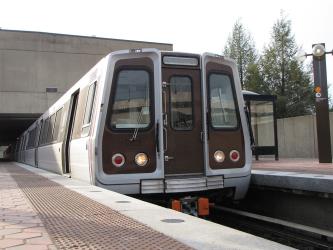
Subway from Union Station, Red Line Center Platform to Farragut North, Red Line Center Platform
- Ave. Duration
- 7 min
- Frequency
- Every 10 minutes
- Estimated price
- $2–3
- Website
- https://www.wmata.com
- standard fare after 9:30 p.m
- $2–3
Subway from Farragut West, Blue/Orange/Silver Line Track 2 Platform to Franconia-Springfield, Blue Line Center Platform
- Ave. Duration
- 33 min
- Frequency
- Every 15 minutes
- Estimated price
- $2–3
- Website
- https://www.wmata.com
- standard fare after 9:30 p.m
- $2–3
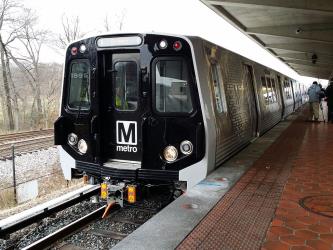
Subway from Union Station, Red Line Center Platform to Metro Center, Red Line Track 2 Platform
- Ave. Duration
- 5 min
- Frequency
- Every 10 minutes
- Estimated price
- $2–3
- Website
- https://www.wmata.com
- standard fare after 9:30 p.m
- $2–3
Subway from Metro Center, Blue/Orange/Silver Line Center Platform to Franconia-Springfield, Blue Line Center Platform
- Ave. Duration
- 36 min
- Frequency
- Every 15 minutes
- Estimated price
- $1
- Website
- https://www.wmata.com
- standard fare after 9:30 p.m
- $1

- Phone
- +1 214-849-8100
- [email protected]
- Website
- greyhound.com
Bus from Washington Union Station to Springfield Bus Stop
- Ave. Duration
- 25 min
- Frequency
- Twice daily
- Estimated price
- $2–5
- Website
- https://www.greyhound.com/
- Phone
- 703-339-7200
- [email protected]
- Website
- fairfaxconnector.com
Bus from Franconia-Springfield Metro Bay G to 7620 Backlick Rd
- Ave. Duration
- 5 min
- Frequency
- Every 30 minutes
- Estimated price
- $1–3
- Website
- http://www.fairfaxconnector.com
- Schedules at
- http://www.fairfaxcounty.gov/connector/routes/
- Senior 65+, Disabled
- $1
- Adult
- $2–3
Bus from Franconia-Springfield Metro Bay G to 7620 Backlick Rd
- Ave. Duration
- 5 min
- Frequency
- Every 30 minutes
- Estimated price
- $1–3
- Website
- http://www.fairfaxconnector.com
- Schedules at
- http://www.fairfaxcounty.gov/connector/routes/
- Senior 65+, Disabled
- $1
- Adult
- $2–3
Bus from Franconia-Springfield Metro to Fort Belvoir North Area
- Ave. Duration
- 12 min
- Frequency
- Hourly
- Estimated price
- $1–3
- Website
- http://www.fairfaxconnector.com
- Schedules at
- http://www.fairfaxcounty.gov/connector/routes/
- Senior 65+, Disabled
- $1–2
- Adult
- $2–3
- Ave. Duration
- 20 min
- Estimated price
- $45–60
Grand Cab
- Phone
- +1 202-269-6690
- Website
- grandcab.com
Washington DC Taxi Service
- Phone
- +1 202-657-0008
- Website
- dctaxiservice.com
Yellow Cab DC
- Phone
- +1 (202) 544-1212
- Website
- dcyellowcab.com
Want to know more about travelling around United States
Rome2Rio's Travel Guide series provide vital information for the global traveller. Filled with useful and timely travel information, the guides answer all the hard questions - such as 'How do I buy a ticket?', 'Should I book online before I travel? ', 'How much should I expect to pay?', 'Do the trains and buses have Wifi?' - to help you get the most out of your next trip.
Related travel guides
Need to know: Greyhound
Read the travel guide